0200 hrs- Mike called Seattle Traffic control and they turned us over to Tofina Traffic Control for the strait. Tofina is on Vancouver Island. They pick us up on radar and will track our course and speed of 4k at 82TC. They alert us there are 2 fishing boats adrift ¼ nm north of us and we will pass south of them in 1 hour. They were tracking all ships north of 48 degrees and the strait.. There were 2 cruise ships Fiord and Royal Viking Sea approaching Cape Flattery during this time. 2 Russian vessels and 500 fishing fleet vessels. It was very interesting to listen as he moved ships around. Fog continued and at daylight we had and lost 2 salmon and landed one. We are having poor visibility and the place is crawling with lots of recreational fisherman. They appear out of no where and we are dodging them left and right.
0800 hrs we are 7.5nm from the cape. We are all excited, to say the least, however we stand vigilant..
0942hrs. Our Loran alarm goes off telling us we have reached our waypoint at Cape Flattery, but everything is shrouded in dense fog. We are putting all our faith into our Loran fixes and Dead Reckoning Positions(DR) and continue to hold our course for Neah Bay.
Mike quickly computes our real ETA and compares it to our estimated ETA from Hanalei.
We miss our estimated ETA by 6hrs, 57 minutes and 39 seconds. Mike writes in the log book. 98.67% Accurate. AW SHUCKS!
1000 hrs-we move out of the fog bank which is a wall stretching from Cape Flattery to Vancouver Island. The sky is blue, the trees green and the snow capped Olympic mountains take your breath away.
 |
| Flags go up Mike fixes SSB antenna |
1200hrs we arrive at Neah Bay entrance buoys. We tie up, get motel room, do tons of laundry, sleep, eat and make lots of phone calls.
 |
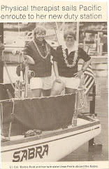
| Well Done, Well Done A happy Captain and her crew. |


