12 June 2009: Friday
At 1125 I ent er the slough for Rooster Rock State Park. The depths are 7-12 feet. I enter and decide it would be best to be on the dock out in the center without a land attachment. This means I will be rowing ashore to go to the head, but it also means that since this will be a weekend there will be lots of dock fisher people. This way I will have more privacy.


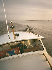
I cast off my dock lines at 0830 and head up river. Rooster Rock lies 129 statute miles from the ocean and Government Island lies 116 sm from the ocean. In between these 2 sites the river takes a long s-bend as it goes by Camas and Washougal Wa. There are many shoals and rocky outcroppings. Staying in the channel is critical and made easy by picking up the range markers on shore. You have a set ahead of you and behind you for reference and when in doubt you can plot a course to double check your position. The current can be running fast with lots of eddys and rips. I'll be looking for Jensen's cove which someone told me about. Their yacht club anchors in there and it is on the Oregon side across from Lady island. I cruise in close to shore looking for an opening but am unable to find it. I see a nice anchorage site behind some large log booms but know that is not what I am looking for. I pull to port and head back into the channel when in between the barge haul out area I see an opening. which would be the place. I'm not that impressed and it looks a bit too commercial and it is near the high tension wires which cross the river. Perhaps I will take a look on my downriver leg.
At 1015 my speed slows to 2.9k as I make another bend in the river. I'm at Camas-Washougal.
At 1015 my speed slows to 2.9k as I make another bend in the river. I'm at Camas-Washougal.
The red nun is being forced over by the current and there is a 2 foot hole at the base. Up river near Reed Island I see a 3 foot sturgeon leap out of the water off my port side. I eye the Reed Island area with inte rest as it is noted for a nice anchorage.
 rest as it is noted for a nice anchorage.
At 1125 I ent
 er the slough for Rooster Rock State Park. The depths are 7-12 feet. I enter and decide it would be best to be on the dock out in the center without a land attachment. This means I will be rowing ashore to go to the head, but it also means that since this will be a weekend there will be lots of dock fisher people. This way I will have more privacy.
The sun is shining, I unload Pashmina from the cabin top, stow my Ann Gash ditty bag and I have a plan. When I was here a few years ago I noticed a culvert on the rear end of the lagoon. Today the water level is very high. I wonder what is on the other side? It goes under hwy 84 which is a 4 lane divided road. On the chart there is a lake, but doesn't look connected to this lagoon and further beyond is Young Creek which feeds the lake. I believe that it is all connected and today I'm going to find out. I have a life jacket, water, cell phone, binoculars and camera.
I di nghy over to take some pictures of the outcroppings of columnar ba
 salt and the swallow nests. I row up to the culverts and take a peak through them and see some kayaks coming down. 2 ladies appeared and reconfirmed there is a lake and a river. The culvert is too narrow for me for me to row, but I can reach the ceiling and propel myself forward "letting my hands do the walking". The ceiling while dark is made of blocks of stone. I can't feel any vibration from the traffic going over head. I can say I have ever done this before. This is a totally new experience for me and yes, there is light at the end of the culvert.
 nghy over to take some pictures of the outcroppings of columnar ba
 salt and the swallow nests. I row up to the culverts and take a peak through them and see some kayaks coming down. 2 ladies appeared and reconfirmed there is a lake and a river. The culvert is too narrow for me for me to row, but I can reach the ceiling and propel myself forward "letting my hands do the walking". The ceiling while dark is made of blocks of stone. I can't feel any vibration from the traffic going over head. I can say I have ever done this before. This is a totally new experience for me and yes, there is light at the end of the culvert.

As I emerge from the culvert there is a beautiful lake with majestic cliffs and casca ding waterfalls. What a delightful surprise and a spectacular view
 . I see Crown Point which is 700 ft high on the cliff and provides a unparalleled view of the beginning of the Columbia Gorge. The La Tourell Falls I believe are the ones I am looking at. Many of these gorge mountain tops are 3000 ft high, however have all be shrouded in mist. I row up to try to find where these falls enter the lake, but realize there is a railroad track between the lake and the bottom of the falls. I
  can hear the falls as they cascade down the mountain side. A great blue heron sits quietly nearby. I hear a heron rookery with all the babies squawking but am unable to locate the rookery due to the density of the forest. The cottonwoods are close to 80-100 feet tall. There are some big fish in here rolling and jumping along the shore. I row down to the beginning of the lake and into the creek area, It is just so lovely to look at. A big meadow is off to the right. I return to the culvert and re-enter the lagoon at Rooster Rock. Shatoosh is waiting for us to return and interested in our trip. This has been such a wonderful treat for me. I dearly love exploring in Pashmina. It is the best. My trip has taken me 1.5 hours to complete. I realized many years ago that in order for my spirit to soar I need lots of time in nature, exploring, being on the water, being in the stillness and oneness
  of this earth. My happiness meter just exploded.
 ding waterfalls. What a delightful surprise and a spectacular view
 . I see Crown Point which is 700 ft high on the cliff and provides a unparalleled view of the beginning of the Columbia Gorge. The La Tourell Falls I believe are the ones I am looking at. Many of these gorge mountain tops are 3000 ft high, however have all be shrouded in mist. I row up to try to find where these falls enter the lake, but realize there is a railroad track between the lake and the bottom of the falls. I
  can hear the falls as they cascade down the mountain side. A great blue heron sits quietly nearby. I hear a heron rookery with all the babies squawking but am unable to locate the rookery due to the density of the forest. The cottonwoods are close to 80-100 feet tall. There are some big fish in here rolling and jumping along the shore. I row down to the beginning of the lake and into the creek area, It is just so lovely to look at. A big meadow is off to the right. I return to the culvert and re-enter the lagoon at Rooster Rock. Shatoosh is waiting for us to return and interested in our trip. This has been such a wonderful treat for me. I dearly love exploring in Pashmina. It is the best. My trip has taken me 1.5 hours to complete. I realized many years ago that in order for my spirit to soar I need lots of time in nature, exploring, being on the water, being in the stillness and oneness
  of this earth. My happiness meter just exploded.
Day's run: 11.4 nm Total: 25.8 nm


