23 May 1792- Day 4: Oro Bay, Anderson Island to Wednesday-Herron Island
The rains had stopped, but the dense fog shrouded their shoreline boats and delayed their departure until the late hour of 0800hrs. Their course took them into the Nisqually River delta which is a very shallow marshland and tidal flatland. Numerous Indian canoes greet them and trading is frequent. Lt. Puget is pleased to see these friendly Indians and comments that they are not shy, but rather welcoming in nature. Mr. Menzies, however noticed a familiar face in the crowd. Old One-Eye, from Alarm Cove was amongst them. They ignored him and his canoe and traded only with the friendly ones. Upon finding themselves in 4-5 feet of water and not wishing to go aground, they departed and headed across the large bay holding Johnson Point to port and Devil’s Head to starboard. They continue to row westward into Case Inlet where they made camp quickly on Wednesday-Herron Island. And by 1400hrs another southeastern, black-skied storm with wind gusts and rain hit them hard and continued for the remainder of the day.
Day’s Run: 15nm
Total Run: 69nm
---------------------------------------------------------------------------------------------------
11 June 2012 Monday Day 4 Shatoosh- Jarrell's Cove to
Day light comes early in these latitudes so we get up and take our time, but are well on our way by 0730. We are cruising slowly out of Jarrell's cove, not in any rush and the morning is lovely and sunny, which always adds to the day. We pass under the Harstene Island Bridge and slow down to find Puget’s stop for the night in a cove on the mainland from which he can see the passage between Squaxin Island and Harstene and the remainder of Pickering Passage with the Continental Shoreline to starboard. This is a confusing encampment, whether they are on Harstene/Squaxin/ or mainland. Blumenthal believes Menzies is saying they might be camped on Squaxin Island rather than the mainland.
When I positioned Shatoosh it becomes crystal clear. We are seeing Peale Passage and Pickering Passage with Squaxin between. In the book Peteer Puget the authors Wing and Newell suggest they are on the mainland.
Just as a side note here, often the journals are written in hindsight, just as I am typing my blog now. It is hard to journal in real time or in the same day, so as positions and facts become clearer in hindsight and when one can muster up some free time the notes get written. I scribble notes in my log book that take place through out the day and then can blog about them later. Some days are longer and more exhausting than others and by the time you pull into port/anchorage, cook dinner, clean the dishes, then perhaps one is too tired to blog/ write in a journal. When you still have to figure what the plan for the next day is , what the weather report is, what the tides/winds will be, and departure time. Some nights you just go to bed, before dark settles into Shatoosh’s cabin and pull your bedroll over your head to cut the light and cold out, and sleep for 9 hours. I’m certain the explorers did much of the same as there was so much to do to document the voyage, but just to live in their harsh environment, build fires, cook and clean up, reload the boats, try to stay dry and warm when it was raining and cold and on the 90 degree days, stay hydrated while you are rowing 16 hour days. As the miles accumulate on the log and the days advance on the calendar, my appreciation of the explorers deepen, carving grooves into my being, that can never be erased. Too Tall and I often reflect and compare the hardships placed upon the Lewis and Clark Corps of Discovery and the HMS Discovery. We share that while these explorers had many hard times, we both agree the ultimate hardship, without a doubt, was Shackleton’s Expedition to the Antartica, written about in the book, Endurance, Shackleton’s Incredible Voyage, by Alfred Lansing.
After reading and re-reading so many segments of the different books, I have grown to appreciate Menzies Journal as described by Blumenthal. Menzies is a scientist and an observer. He is detail oriented and writes longer explanations than the others do. So when I have a question about something I go to Menzies’ Journal first. Even then, with their British Engish it is often hard to understand. I have grown to appreciate even more Richard Blumenthals book about the 12 Journals of the Discovery. He is an amazing man to pay so much attention to detail in compiling all this data but he brings clarity to it all. If you are interested please read , With Vancouver in Inland Washington Waters.
We see another interesting nitch in the Pickering Passage shoreline which houses the Olympia Yacht Club out station. These Yacht Clubs certainly know where to put their out stations. What a lovely place.
We cruise by Hungerford Point and approach Hammersley Inlet. Puget did not enter this and we can see why. There is a dogleg turn which makes it look like a small cove. Since they did not explore this we decide to pass it and I will save it for later.
At 0845 we pass Steamboat Island to port, which stands guard to Totten Inlet. The morning sun is holding and we feel we need to cover inlets like Puget did in these parts; down one side and out the other. Just as Puget describes there are many lovely places in this inlet.
We go south as far as Little Skookum inlet, which would need to be explored in Pashmina at a later date. Our 8 nm loop is pleasant and gives Too Tall time to eat a peanut butter and jelly sandwich. He is enjoying sitting in the cockpit and scoping out the homes with his fancy binocs. While populated with hundreds of houses we still see deer in the yards, eagles, osprey, seals, crows, sea gulls and numerous flocks of pigeon guillemots. It is 1009 when we pass Steamboat island again with its unique sandspit and car causeway going to this crowded tiny high bluffed northern headland.
As few of the houses on the north bluff are falling off the edge as the bluff deteriorates. They have even put concrete covering on the bluff to try to hold it. From the looks of it, and from an engineering point of view , I don’t think it is working.
Too Tall is fast on the draw with his smart phone and is wondering about the geology of this area and what causes these inlets. Google states that Seattle was once under 3400 feet of ice and as it warmed the ice started moving. This shows how all these ice age erratic rocks show up on all the shores around the sound. We have seen some big ones.
We pass Flapjack Point and are in 53 feet of water and at 1130 we find ourselves at Puget’s Friendly Inlet” 47 degrees, 05 minutes N and 122 degrees, 58 minutes W. This is a beautiful small cove and inlet. As we approached I saw a ?Sparkman Stephens hulled sailboat which was very similar to a Swan 36 but smaller. Very nice green hulled vessel.
We adorn our hair with feathers just like the Friendly Indians did and admire ourselves with our looking glasses.
We pull off to the out bound side of Eld Inlet in 40 ft of water at 1200 hrs and turn the engine off and drift while we have lunch. 47 degrees, 10 minutes N, 122 degrees, 56 minutes. W. The sun continues and, by the way, I dressed in shorts today just for the hope of this window of solar energy. This is my kind of day.
The north spit of Cooper Point has one of the most loveliest homes with a view of Mt Rainier. It is gorgeous. We enter Budd inlet and follow the navigational buoys/markers which lead into Olympia, the capital of Washington. Before we left I looked at Google Earth and took Mr Whidbey’s latitude of 47 degrees 03 minutes N to see where it would be located. The latitude line runs from the second piling at the dock by Anthonys Restaurant. We had a wonderful celebration dinner and the table we sat at was on that specific latitude.. Can you believe that? We looked out at Shatoosh who was docked at that latitude, as well. Oh, the magic and the mystery of selecting a dock. We ate where Mr. Whidbey took his famous noon sight. I wonder if Anthony’s Home Port knows this or as Too Tall Tom would say, “I wonder if they would even care?”
Docking and dining on Whidbey's Latitude.
On p42 of Puget’s Journal of Richard Blumenthal’s book, which at the end of the journal, Puget says the lat/long of the last inlet is:
11 June 2012 Monday Day 4 Shatoosh- Jarrell's Cove to
Day light comes early in these latitudes so we get up and take our time, but are well on our way by 0730. We are cruising slowly out of Jarrell's cove, not in any rush and the morning is lovely and sunny, which always adds to the day. We pass under the Harstene Island Bridge and slow down to find Puget’s stop for the night in a cove on the mainland from which he can see the passage between Squaxin Island and Harstene and the remainder of Pickering Passage with the Continental Shoreline to starboard. This is a confusing encampment, whether they are on Harstene/Squaxin/ or mainland. Blumenthal believes Menzies is saying they might be camped on Squaxin Island rather than the mainland.
When I positioned Shatoosh it becomes crystal clear. We are seeing Peale Passage and Pickering Passage with Squaxin between. In the book Peteer Puget the authors Wing and Newell suggest they are on the mainland.
 |
| Looking at passage between Harstene and Squaxin and Squaxin and continental shore |
 |
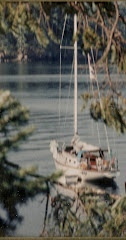
| Looking off our stern into a cove where they could have easily camped. |
Just as a side note here, often the journals are written in hindsight, just as I am typing my blog now. It is hard to journal in real time or in the same day, so as positions and facts become clearer in hindsight and when one can muster up some free time the notes get written. I scribble notes in my log book that take place through out the day and then can blog about them later. Some days are longer and more exhausting than others and by the time you pull into port/anchorage, cook dinner, clean the dishes, then perhaps one is too tired to blog/ write in a journal. When you still have to figure what the plan for the next day is , what the weather report is, what the tides/winds will be, and departure time. Some nights you just go to bed, before dark settles into Shatoosh’s cabin and pull your bedroll over your head to cut the light and cold out, and sleep for 9 hours. I’m certain the explorers did much of the same as there was so much to do to document the voyage, but just to live in their harsh environment, build fires, cook and clean up, reload the boats, try to stay dry and warm when it was raining and cold and on the 90 degree days, stay hydrated while you are rowing 16 hour days. As the miles accumulate on the log and the days advance on the calendar, my appreciation of the explorers deepen, carving grooves into my being, that can never be erased. Too Tall and I often reflect and compare the hardships placed upon the Lewis and Clark Corps of Discovery and the HMS Discovery. We share that while these explorers had many hard times, we both agree the ultimate hardship, without a doubt, was Shackleton’s Expedition to the Antartica, written about in the book, Endurance, Shackleton’s Incredible Voyage, by Alfred Lansing.
After reading and re-reading so many segments of the different books, I have grown to appreciate Menzies Journal as described by Blumenthal. Menzies is a scientist and an observer. He is detail oriented and writes longer explanations than the others do. So when I have a question about something I go to Menzies’ Journal first. Even then, with their British Engish it is often hard to understand. I have grown to appreciate even more Richard Blumenthals book about the 12 Journals of the Discovery. He is an amazing man to pay so much attention to detail in compiling all this data but he brings clarity to it all. If you are interested please read , With Vancouver in Inland Washington Waters.
We see another interesting nitch in the Pickering Passage shoreline which houses the Olympia Yacht Club out station. These Yacht Clubs certainly know where to put their out stations. What a lovely place.
We cruise by Hungerford Point and approach Hammersley Inlet. Puget did not enter this and we can see why. There is a dogleg turn which makes it look like a small cove. Since they did not explore this we decide to pass it and I will save it for later.
At 0845 we pass Steamboat Island to port, which stands guard to Totten Inlet. The morning sun is holding and we feel we need to cover inlets like Puget did in these parts; down one side and out the other. Just as Puget describes there are many lovely places in this inlet.
 |
| Steamboat Island to Port- Totten inlet |
 |
| Totten Inlet |
We go south as far as Little Skookum inlet, which would need to be explored in Pashmina at a later date. Our 8 nm loop is pleasant and gives Too Tall time to eat a peanut butter and jelly sandwich. He is enjoying sitting in the cockpit and scoping out the homes with his fancy binocs. While populated with hundreds of houses we still see deer in the yards, eagles, osprey, seals, crows, sea gulls and numerous flocks of pigeon guillemots. It is 1009 when we pass Steamboat island again with its unique sandspit and car causeway going to this crowded tiny high bluffed northern headland.
 |
| Houses on Steamboat Island |
Another dilemma occurs about their next campsite. As I had initially read the description of their location I had thought perhaps the “narrow pennisula” was the sand spit at Steamboat Island, however as we are moving around the point I re-read Menzies' description and he states the campsite is located 2 miles east on the eastern side of the narrow peninsula, which is Hunter’s Point. As we pass Hope Island we get a full view of Mt. Rainier.
At 1030 hrs we pass Hunter Point and turn south into Eld Inlet.
At 1030 hrs we pass Hunter Point and turn south into Eld Inlet.
Too Tall is fast on the draw with his smart phone and is wondering about the geology of this area and what causes these inlets. Google states that Seattle was once under 3400 feet of ice and as it warmed the ice started moving. This shows how all these ice age erratic rocks show up on all the shores around the sound. We have seen some big ones.
We pass Flapjack Point and are in 53 feet of water and at 1130 we find ourselves at Puget’s Friendly Inlet” 47 degrees, 05 minutes N and 122 degrees, 58 minutes W. This is a beautiful small cove and inlet. As we approached I saw a ?Sparkman Stephens hulled sailboat which was very similar to a Swan 36 but smaller. Very nice green hulled vessel.
We adorn our hair with feathers just like the Friendly Indians did and admire ourselves with our looking glasses.
 |
| Hira admires herself in looking glass and approves. |
 |
| These feathers are really 2 feet long but Too Tall makes them appear small. |
 |
| Trading beads |
 |
| Hira shows Too Tall her cedar rope from Haida Gwaii |
We pull off to the out bound side of Eld Inlet in 40 ft of water at 1200 hrs and turn the engine off and drift while we have lunch. 47 degrees, 10 minutes N, 122 degrees, 56 minutes. W. The sun continues and, by the way, I dressed in shorts today just for the hope of this window of solar energy. This is my kind of day.
The north spit of Cooper Point has one of the most loveliest homes with a view of Mt Rainier. It is gorgeous. We enter Budd inlet and follow the navigational buoys/markers which lead into Olympia, the capital of Washington. Before we left I looked at Google Earth and took Mr Whidbey’s latitude of 47 degrees 03 minutes N to see where it would be located. The latitude line runs from the second piling at the dock by Anthonys Restaurant. We had a wonderful celebration dinner and the table we sat at was on that specific latitude.. Can you believe that? We looked out at Shatoosh who was docked at that latitude, as well. Oh, the magic and the mystery of selecting a dock. We ate where Mr. Whidbey took his famous noon sight. I wonder if Anthony’s Home Port knows this or as Too Tall Tom would say, “I wonder if they would even care?”
 |
| Olympia, the Capital |
 |
| Mr Whidbey's Latitude |
 |
| We are docked on the 47 degrees, 03' 00' parallel |
 |
| We dine on the 47 deg 03' 00" parallel |
Docking and dining on Whidbey's Latitude.
On p42 of Puget’s Journal of Richard Blumenthal’s book, which at the end of the journal, Puget says the lat/long of the last inlet is:
47 degrees, 03 minutes N, 237 degrees, -18 minutes E( one has to subtract 360 from this- giving the longitude of 122 degrees, 42 minutes) This longitude is well east of Olympia which would be incorrect. The longitude at Anthony’s restaurant is 122 degrees and 54’.274 minutes.
Days run: 34 nm
Total: 146nm


