For all the readers around the world, you might not be familiar with this bar. It is one of the most dangerous river bars in the world, taking over 2000 lives. When the mighty force of the flowing waters from the mountains in British Columbia converges with the incoming waters of the Pacific ocean tremendous silting occurs. The bar is 3 miles wide and 6 mile long, with a deep water channel dredged for ocean going vessels.Winter storms are terrifying on the bar and the World Class United States Coast Guard train their rescue personnel here. All commercial ships who enter have to have a Columbia River Bar Pilot on board, who takes command of the vessel to transit the ship across the bar. Once across, then another River Pilot takes command of the vessel and takes it up the river to the numerous ports along the way. Ships come from all around the world and I have faithfully kept a log of the ships that cross my path. It becomes an interesting read which tests my knowledge of world geography and international flags..
My Scottish Gilmour ancestors, aboard the Ship, "Pekin", ran aground on this bar after a 6 month journey in 1850, from London to Port Hardy, Vancouver Island, BC via Cape Horn and the Sandwich Islands (Hawaiian Islands). Mrs.Boyd Gilmour, delivered a son, who she named, Allyn Columbia Gilmour. On his birth certificate it reads, place of birth: Columbia River. While I have cruised this river, I have flown my Scottish flag and worn my orange fleece pullover with my Scottish emblem on it to honor my Columbia River Ancestors.
After crossing the bar we head north to take on the coastal Pacific waters of Washington State and our 1st port of call is Westport, WA in Grays Harbor, 2nd port is La Push, a Quilayute Indian Village on the Quilayute River.The most western points are Cape Flattery, Tatoosh Island and Duntze Rocks which lie about 10 nm west of Neah Bay. This takes us up one side of the Olympic Peninsula. Rounding the western corner is the 3rd port of Neah Bay, another Indian Community of the Makah Tribe. This is located on the Straits of Juan de Fuca, the dividing waters of Vancouver Island, British Columbia and the United States of Washington state.
The Salish Sea by Stefen Freelan/with persmission
to copy.
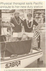
Once we get to Neah Bay, I will breathe a sigh of relief. I remember so well, back in 1982, when we were sailing Sabra from Hawaii to Washington and we approached Cape Flattery, in typical summer fog, that stretched all the way across the straits to Vancouver Island. 45 minutes later, we broke through the solid wall of fog and entered beautiful blue sky, the tall, green evergreens, and the snow capped Olympic Mountain range. Neah Bay was ahead and to starboard, just where she was supposed to be. After 21 days at sea, weathering calms and gales, she was a sight to behold and it is still crisp in my memory. I am visualizing calm seas, blue skies, no fog and white, snow capped Olympic mountains and Neah Bay, right where she is supposed to be.
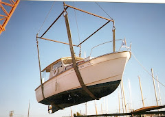
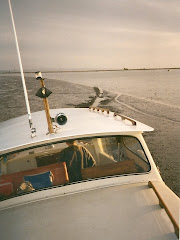
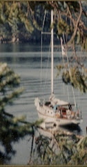
Unlike Sabra, which was equipped with a Radio Direction Finder, a Single Side Band Radio, and Loran( in 1982 there wasn't full time GPS), Shatoosh has Radar, GPS, and Chartplotter. As long as I have my Verizon signal, I can access the internet and pick up the AIS(Automatic Identification System)on the Columbia River Bar Pilots Association site, the Wind on the water site, I can dial a weather buoy on my cell phone and get an on time report and I can get 10 day reports.The AIS gives me plots of ships traveling up and down the coast and in and out from the pacific ocean, photos of each ship, tonnage, length, speed and course and destination. So Shatoosh, my 39 year old, 25 ft. river cruiser, built by Swedish seamen, is better equipped navigationally, than my Finnish built, ocean going 36 ft Swan was in 1982. Need I say, that I am, also, better equipped to handle this adventure. My crew and first mate, Joyce, is most knowledgeable in her boating/navigational skills. She can troubleshoot/ repair anything that comes our way. She is able to maintain her "cool" under any adverse situation. It is for these and many more reasons, that she is my first choice to come aboard and join me on this adventure. Oh, I forgot to mention, she is younger, stronger and more agile than I am!!!
The Pacific coastal waters can be Shatoosh's biggest test. While I did take Shatoosh out under the Golden Gate Bridge in San Francisco Bay into the Pacific Ocean, it was a clear, sunny, flat seas, December day. It was a piece of cake. She certainly handled those terribly confused, reflected, washing machine waves that the Columbia River Gorge can dish up, but the Pacific Ocean listens to another drumbeat. I want a window of calm water and weather, for our journey up the coast and down the Straits. It is not common to have many consecutive days of clear weather, so we might have to lay over extra days in Westport or La Push. If the weather gets bad while underway and those bars become closed, it means we will have to stay out and continue northward and cruise at night. I can cruise at night and have lots of experience doing so, but this coast is totally dark, there are few lights, lots of crab pots, whales and fishing boats.
Recently, after the start of the Astoria-Victoria offshore race had begun, a humpback whale breached next to one of the vessels and crashed into the starboard side, severing all the rigging and dismasting her. The vessel had to be towed back to Astoria. All happening in broad daylight. I really would prefer daylight hours to see the dangers and wave sets.
So, the key is to be patient, not be in a big hurry, wait for the weather to open up and cruise the daylight hours in flat seas. I don't think I am asking too much, do you?


