During the exploration of the Voyage of Discovery in 1792, the British ships, HMS Discovery and HMS Chatham departed Possession Sound on 5 June 1792. They had just completed surveying and charting all the waters in the San Juan Islands, Admiralty Inlet, Hood Canal, and the waters south of Restoration Point on Bainbridge Island. Captain Vancouver claimed possession of the land and waters naming the Gulf of Georgia and New Georgia for His Majesty, King George III. Their next destination was Strawberry Bay on Cypress Island, a place they could proceed north to begin surveying and charting the northern mainland and coastal waters of Vancouver Island, British Columbia.
5 June 1792: The tide was ebbing and there was a nice breeze over their sterns as they made their way south out of Possession Sound. They rounded the southern tip of the island that would soon be named Whidbey’s Island by Captain George Vancouver and changed their course north and west into Admiralty Inlet.
Flash forward to January 2008- when a diver, Doug Monk, accidentally finds an anchor off the northwestern shore of Whidbey Island in 35 feet of water. Not just any anchor, but a 9 foot, 900 pound anchor with a 100 feet of chain. Together with Scott Grimm they formed Anchor Ventures LLC and have spend 6 years investigating weather patterns, tidal flows, journal, logs of the Chatham and Discovery and visiting England’s Patent Office to examine types of anchors. They contend that the Chatham was not sailing in the company of the Discovery and had anchored offshore of Whidbey Island and this anchor belongs to the Chatham. They are convinced of this fact.
In February 2014, the Seattle Times and the South Whidbey Record announced to Puget Sounders that Monk and Grimm have discovered an anchor, perhaps the anchor of the HMS Chatham. Treasure hunters have been looking in Bellingham Channel near Cypress Island for over a 100 years. They are convinced this anchor is the lost anchor of the HMS Chatham and in a few months the anchor will be removed from its watery grave to be examined and studied.
Lost Anchor Chatham click for video
This is remarkable and certainly gets one’s historical juices flowing. This week it was the hottest topic in question in 3 historical meeting I attended. I am an amateur Voyage of Discovery historian, the Director of the Peter Puget Memorial Project, and I say not so fast, fellows. I have read the journals, logs of Puget, Vancouver, Menzies, Baker, Swaine, Heddington, Hanson, Baker, Broughton and they clearly state the ships were traveling in company with the HMS Discovery and had planned to anchor in Strawberry Bay on the west side of Cypress Island. In my revisiting these journals, I discover some interesting facts that are note worthy for discussion.
Lets re-board our vessels as they head out of Possession Sound on 5 June 1792 and see just where they went. At dusk they passed Foulweather Bluff to port and at midnight with lightening winds and a flooding tide Captain Vancouver anchors the Discovery in 22 fathoms ½ way between Oak Cove and the top of Marrowstone Island and ½ mile offshore in Admiralty Inlet. Both Vancouver and Menzies state the flooding tide had swept the Chatham west into Oak Cove and she anchored earlier than the Discovery. They are about 5 miles apart.
 |
| 5 June Chatham anchors Oak Cove Discovery anchors 1/2 way between Oak Cove & Marrowstone I. |
6 June 1792 The ships weigh anchors at 0700 hrs and are traveling together nicely with a westerly wind and a strong ebbing tide. By noon they were outside of Admiralty inlet and upon reaching 1 mile past Point Partridge the Discovery passed over 10 fathoms of water but soon increased to 20-30 fathoms. This would be Partridge Banks. The Chatham is still in company. At 1500hrs the winds were dying so they anchored north of the banks, the eastern shore was 6 miles and a low, sandy island (Smith Island )was north of them by 3-4 miles. Strawberry Bay was 18 miles to the north. Captain Vancouver, Lt Broughton the Commander of the Chatham and Mr. Menzies went in one of the small boats to explore the small island. Upon return to the vessels, they weighed anchors at 1900hrs, but with light winds they fell south of their position and re-anchored 2200hrs until 0600hrs on the 7 June. After trying to set sail north again they were forced to anchor again near Smith Island. At this time Captain Vancouver dispatched Mr. Whidbey, Lt Puget and Lt Manby in the launch and cutter with a week’s provisions to explore the continental shore to the north and east, where they could see an opening in the shoreline. (Deception Pass) It remained calm until 1600hrs where they weighed anchor and proceeded north 5-6 leagues(10-18 miles) and anchored in the evening near many islands on the north side of the Strait.( off of Lopez Island, near Cape St. Mary in 37 fathoms).
 |
| Red- Route of Chatham and Discovery Blue- Route of Puget and Whidbey |
We are now reaching the critical days that lie ahead for the anchoring of both vessels into Strawberry Bay.
8 June: In Menzies journal he makes an interesting statement: While waiting out the ebbing tide Lt Broughton asks him to join him in a small boat to explore the numerous small islands to the west of their anchorage. So, Lt Broughton was not on board his vessel, the Chatham during this critical time of approaching Strawberry Bay and Cypress Island. Both vessels weighed anchor at 1500hrs and plied northward. With lightening winds and the assistance of the men of the oar in their small boats they were able to assist the Discovery into their anchorage in Strawberry Bay between Strawberry Island an Cypress Island at 1800hrs in 16 fathoms of sand bottom. Lt Hanson is probably in command of the Chatham, along with Lt Johnstone( sailing master) and while they are attempting to gain the anchorage are caught with lightening wind/flooding tide and are pulled off to the eastward point into Bellingham Channel. Lt Hanson states in his journal on 9 June( different date from Vancouver, Menzies journal stating the 8th) the tide was so rapid it was setting the vessel into a small bight( possibly Deep Water Bay) They launched a small boat to help tow the vessel round and after setting the stream anchor and rounding up the cable broke. They let go of their best bower anchor. After waiting for the tide change they used the small boats to sweep for the anchor, but could not retrieve it. Lt Heddington’s journal also confirms this event. In an unsigned journal, the writer describes the events and the location to be Cypress Island, but the date is 9 June. The writer is thought to be either Edward Bell or William Walker of the Chatham.
 |
| Green- Discovery Red- Chatham |
 |
| Green- Discovery Red- Chatham |
On 8 June, Menzies stated at the end of the day, it was late Lt. Broughton stayed on board the Discovery for the night.
9 June: A boat from the Chatham informed Captain Vancouver that she was anchored in a critical situation at the eastward opening of Bellingham Channel at Cypress Island. They had been sweeping for their lost stream anchor without success. On 10 June the Chatham successfully made way to Strawberry Bay and anchored inside of the Discovery in 7 fathoms.
Remember that Lt Puget and Mr Whidbey were exploring in the launch and cutter and after finishing the exploration of Deception Pass and with the confirmation of that the land mass was indeed an Island(Whidbey) they proceeded north around Fidalgo Island and headed down Guemes Channel.. It was at this time that they spotted the Chatham anchored near Cypress Island bearing northwest of them. They rowed to see if there were any new orders for them. The Chatham informed them they had lost their stream anchor and were in the process of sweeping for it without success. Puget and Whidbey then continued on their way east to explore Padilla and Samish Bays and numerous small islands to include Vendovi Island. They returned by taking the northern shore of Cypress Island and returned to the anchored Discovery and the Chatham at 1400hrs on 10 June. Their approximate mileage of exploration was 60nm.
 |
| Puget- Whidbey Route 7-10 June |
11 June: At 0400hrs both the Discovery and the Chatham departed Strawberry Bay sailing north between Strawberry Island and the north point of the bay. They anchored that evening in Birch Bay.
 |
| *** all the routes and anchorages drawn are my estimates*** and do not reflect their exact coordinates. |
Anchor Ventures state:
1. Their Whidbey Island Anchor has a grapple hook attached to the chain which supports the theory that the men of the Chatham were sweeping with a grapple hook.
2. The flukes are in tradition of an Admiralty stream anchor; v-shaped
3. If the Chatham was not sailing in the company of the Discovery, only the journals written by the crew of the Chatham should be acknowledged.
Historians say:
1. The British method of sweeping was not using a grapple hook, but rather rowing out boats with rope lowered to catch the anchor flukes.
2. The flukes on the video of the anchor shows curved flukes.
3. The chain in question is more in the period of 1800.
4. Whether you read the journals of the Chatham, or the Discovery, they all clearly state as the HMS Chatham attempted to reach the western anchorage of the HMS Discovery in Strawberry Bay, the flooding tides in Bellingham Channel swept them to a small bight along the southeastern shore of Cypress Island and it was there they attempted to anchor with a stream anchor. The forces were so great, that the cable broke which forced them to drop their best bower anchor. After sweeping throughout 2 slack tides they were unable to retrieve it. They returned to Strawberry Bay and anchored next to the Discovery.
5. The most distance the ships were separated at anchor was 5 miles; On June 5, the Chatham anchored earlier when the failing wind and tides forced them to anchor in Oak Cove. While the Discovery proceeded farther north and anchored half way up Marrowstone island on its east side. On June 8, the Discovery anchored in Strawberry Bay and the Chatham was forced to anchor on the SE side of Cypress.
6. The only Date the Chatham could have anchored close to the proposed west shore of Whidbey Island would have been on the 5 June. After that date they were outbound of Admiralty Inlet.
It is for these reasons I believe this anchor in question is not the lost anchor of the HMS Chatham. In speaking with Richard Blumenthal, the famous NW Historian and author. He believes the Chatham lost their stream anchor off Cypress. I am really excited about this anchor and respect Anchor Ventures LLC for finding it and pursuing its identification. If not the Chatham then who? The Spanish were in the area but not off Whidbey Island, Wilkes Expedition in 1841, numerous ships exploring, and trading. Perhaps one day soon we will know about this anchor and hopefully someone can find the lost anchor of the HMS Chatham. You treasure hunters continue….At any rate, all of us are continuing to be a part of a new chapter in the Voyage of Discovery.
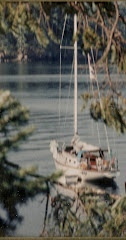
I began reflecting of my own voyage last summer on Shatoosh as I was making my way from Spencer Spit on Lopez island to Cypress Head on Cypress Island. The ebbing strong tide and northerly wind in Thatcher Pass was shoving me down on Decatur Island and I was moving nicely at 10 k. As I entered Rosario Strait, the wind and tide were on my nose and I was having trouble getting any heading. I was traveling at about 3 k, but after alot of up wind and down wind maneuvering I finally was able to get some heading and make my destination for the night. A nice DNR Buoy.
How very exciting. Be Calm, Carry On.
References:
1. South Whidbey Record, Justin Burnett, Feb 6, 2014
2. Seattle Times, Craig Welch, Feb 8, 2014
3. Blumenthal, Richard, With Vancouver in Inland Washington Waters: Journals of 12 Crewmen April-June 1792
4. Meany, Edmond S., Vancouver's Discovery of Puget Sound


